Wednesday 31 January 2024

Best techniques of Point cloud to CAD and Scan to BIM

Introduction:

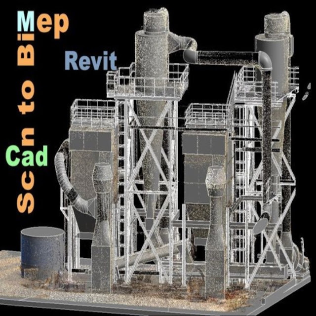
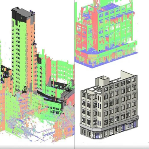
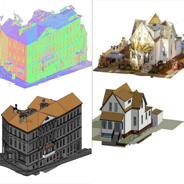
In the realm of architecture and construction, Point Cloud to CAD and Scan to BIM represent innovative methodologies that bridge the gap between traditional design practices and cutting-edge technology. Point Cloud to CAD involves the meticulous conversion of three-dimensional point cloud data, acquired through advanced technologies like laser scanning or LiDAR, into digital CAD environments, offering designers unprecedented accuracy in recreating existing structures. Scan to BIM takes this process a step further, transforming point cloud data into intelligent and parametric 3D models enriched with information about the physical and functional attributes of building elements. Together, these methodologies revolutionize design workflows by providing a more precise representation of as-built conditions, minimizing errors, and fostering enhanced collaboration and data-driven decision-making throughout the lifecycle of construction projects.

point cloud to cad, scan to bim


What is Point cloud to CAD?

Point Cloud to CAD is a transformative process in the field of design and engineering, seamlessly integrating the physical world with digital precision. This methodology involves the conversion of three-dimensional point cloud data, typically captured through advanced surveying technologies like laser scanning or LiDAR (Light Detection and Ranging), into a digital CAD environment. The point cloud, which consists of millions of individual data points representing surfaces and objects within a physical space, serves as a highly detailed and accurate reference. CAD software then processes and interprets this raw point cloud data, allowing designers, architects, and engineers to create precise digital representations of existing structures or environments. This process not only facilitates the preservation of accurate as-built conditions but also empowers professionals to streamline design workflows, reduce errors, and enhance overall efficiency in the creation of digital models for architectural, engineering, and construction purposes. Point Cloud to CAD has become an indispensable tool, offering unparalleled accuracy and a solid foundation for informed decision-making in diverse industries.

Techniques of point cloud to CAD:

·         Data Acquisition and Processing

·         Registration and Alignment

·         Feature Extraction

·         Meshing and Surface Reconstruction

·         Modeling Techniques

·         Quality Control and Validation

·         Integration with CAD Software

·         Collaboration and Documentation

Scan to BIM:

Scan to BIM, an innovative process at the intersection of advanced surveying technologies and Building Information Modeling (BIM), transforms point cloud data obtained through 3D laser scanning or LiDAR into intelligent and parametric 3D models. Beginning with meticulous data alignment and registration to ensure precision, Scan to BIM employs classification and object recognition algorithms to automatically identify and label structural elements within the point cloud. Parametric modeling adds a dynamic dimension, allowing for the creation of intelligent models that adapt to design changes. The management of the level of detail (LOD), interoperability with various software applications, clash detection, and resolution contribute to a streamlined construction process. Additionally, the integration of asset information, thorough documentation, and regular model updates make Scan to BIM a powerful tool not only for design and construction but also for ongoing facility management. Overall, Scan to BIM enhances collaboration, reduces errors, and provides a comprehensive digital representation of the physical environment throughout the project lifecycle.

Techniques of Scan to BIM:

The Scan to BIM process employs a series of techniques to seamlessly transform point cloud data into an intelligent Building Information Model (BIM). Beginning with the meticulous alignment and registration of multiple scans, the data undergoes cleanup and filtering to eliminate noise and enhance accuracy. Advanced algorithms for classification and object recognition automatically identify and label architectural and structural elements within the point cloud, streamlining the modeling workflow. Parametric modeling introduces intelligence to the BIM model, allowing for dynamic properties and adaptability to design changes. Level of Detail (LOD) management ensures that the model provides the necessary information for each project phase. Interoperability with BIM software enhances collaboration, while clash detection and resolution identify and address potential conflicts early in the design process. The integration of asset information, thorough documentation, and regular model updates contribute to a comprehensive BIM model that not only represents the physical structure but also serves as a valuable tool for construction and facility management.

How they work together point cloud to CAD and Scan to BIM?

The Scan to BIM process employs a series of techniques to seamlessly transform point cloud data into an intelligent Building Information Model (BIM). Beginning with the meticulous alignment and registration of multiple scans, the data undergoes cleanup and filtering to eliminate noise and enhance accuracy. Advanced algorithms for classification and object recognition automatically identify and label architectural and structural elements within the point cloud, streamlining the modeling workflow. Parametric modeling introduces intelligence to the BIM model, allowing for dynamic properties and adaptability to design changes. Level of Detail (LOD) management ensures that the model provides the necessary information for each project phase. Interoperability with BIM software enhances collaboration, while clash detection and resolution identify and address potential conflicts early in the design process. The integration of asset information, thorough documentation, and regular model updates contribute to a comprehensive BIM model that not only represents the physical structure but also serves as a valuable tool for construction and facility management.

Conclusion:

Point Cloud to CAD and Scan to BIM work synergistically to facilitate a comprehensive and accurate digital representation of physical structures in the realms of architecture and construction. Point Cloud to CAD serves as the initial bridge between the real world and the digital environment, converting laser-scanned or LiDAR-derived point cloud data into a usable CAD format. This technique ensures precise geometric representation, laying the foundation for subsequent design modifications. Scan to BIM takes this a step further by infusing intelligence into the CAD models.  RVTCAD offering Point Cloud to CAD and Scan to BIM services utilize advanced laser scanning technology. They capture precise three-dimensional point cloud data of physical structures, then employ sophisticated software for data processing, object recognition, and parametric modeling. This process enhances design accuracy, collaboration, and decision-making throughout construction projects, ensuring a seamless transition from the physical to the digital realm.


Monday 29 January 2024

BIM services for seamless scan to Revit Integration

 Introduction:

In the ever-evolving landscape of architectural design and construction, Building Information Modeling (BIM) services have emerged as a transformative force, redefining how projects are conceptualized and executed. One remarkable facet of this technological evolution is the seamless integration of BIM services with scan to Revit workflows. This synergy not only enhances precision and efficiency but also opens up new possibilities in the realm of design and construction.

bim service, scan to revit


The Foundation: Understanding BIM Services:

Building Information Modeling (BIM) is more than just a buzzword; it is a comprehensive approach to design, construction, and project management.   This includes not only the geometry but also spatial relationships, light analysis, geographic information, and more. BIM services have significantly streamlined the design and construction process by providing a collaborative platform for architects, engineers, and other stakeholders to work together in a virtual environment. This shared digital space facilitates better communication, reduces errors, and ensures that all parties involved are working from the same information.

The Evolution of Scan to Revit Integration:

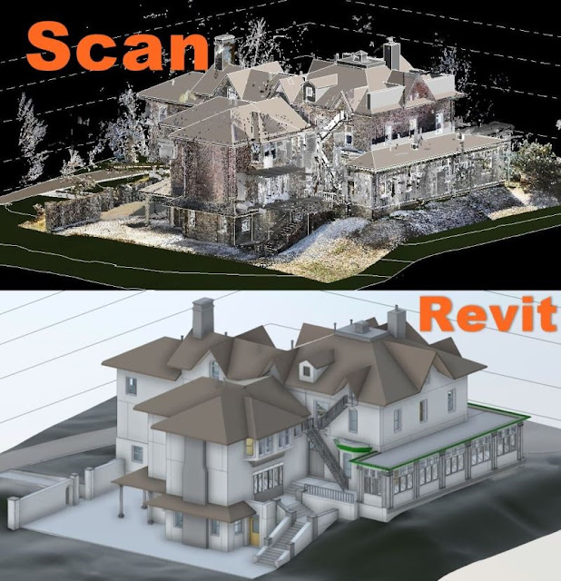
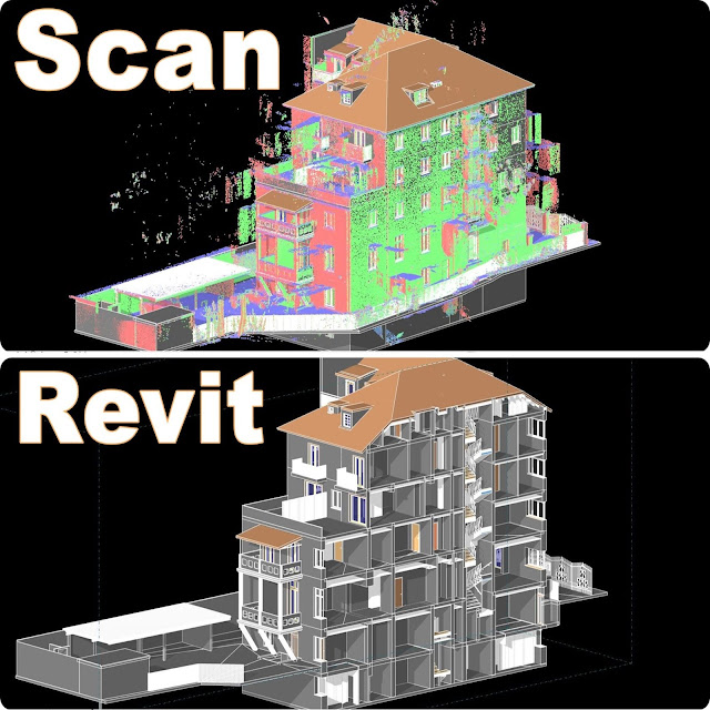
Scan to Revit integration represents a crucial evolution in the AEC (Architecture, Engineering, and Construction) industry. Traditional methods of transitioning from point cloud data to Revit models were often time-consuming and prone to errors. With the advent of advanced BIM services, this process has undergone a remarkable transformation. Scan to Revit integration involves the conversion of laser scan or point cloud data into intelligent 3D models using Autodesk Revit. This integration allows for a more accurate representation of existing structures, enabling architects and engineers to work with real-world data seamlessly. The result is a more precise and efficient design process.

The Advantages of Seamless Integration

Enhanced Accuracy and Precision:

One of the primary advantages of BIM services for scan to Revit integration is the unparalleled accuracy it offers. The digital models created through this process are not only visually faithful to the existing structures but also contain crucial metadata that informs decision-making throughout the project lifecycle. This precision minimizes the margin of error in design and construction, leading to superior outcomes.

Streamlined Workflows:

The seamless integration of BIM services with scan to Revit workflows eliminates the need for manual data translation and conversion. This streamlining of processes results in faster project timelines and reduced costs. Architects and engineers can focus more on design refinement and problem-solving, rather than getting bogged down by tedious data manipulation tasks.

Collaborative Potential:

BIM services inherently foster collaboration, and when integrated with scan to Revit workflows, this collaboration extends to stakeholders involved in the entire project lifecycle. From surveyors capturing point cloud data to architects refining designs, and engineers ensuring structural integrity, the collaborative potential becomes a cornerstone of project success.

Real-world Applications: Renovation and Retrofitting

The integration of BIM services with scan to Revit is particularly valuable in renovation and retrofitting projects. Accurate as-built models generated from scan data serve as the foundation for renovations, ensuring that new designs seamlessly integrate with existing structures.

Facility Management:

Beyond the design and construction phase, the integrated models become invaluable for facility management. The comprehensive digital representation allows facility managers to efficiently plan maintenance, track asset life cycles, and optimize operational efficiency.

Overcoming Challenges and Looking Ahead:

While the integration of BIM services with scan to Revit has brought about significant advancements, challenges persist. The industry must address issues related to interoperability, data security, and training to ensure widespread adoption and optimal utilization of these technologies. As artificial intelligence and machine learning continue to evolve, we can expect BIM services to become smarter and more intuitive. This, in turn, will further enhance the seamless integration of scan to Revit workflows, pushing the boundaries of what is possible in architectural design and construction.

Conclusion:

The marriage of BIM services with scan to Revit integration, augmented by cutting-edge solutions like Rvtcad, represents a pivotal moment in the AEC industry's journey toward efficiency and precision. This synergy not only accelerates project timelines but also elevates the quality of design and construction outcomes. Rvtcad, with its innovative features and tools, adds an extra layer of sophistication to the integration process, enhancing the overall capabilities of BIM services. As technology continues to advance, embracing these integrated workflows will undoubtedly be key to staying at the forefront of the ever-evolving landscape of architecture and construction. The future, it seems, is already here.

Thursday 25 January 2024

Point Clouds and Revit Synergy for As-Built Excellence

Introduction:

In the ever-evolving landscape of architectural and construction design, precision and accuracy are paramount. As-Built drawings, which capture the exact measurements and conditions of existing structures, play a crucial role in renovation projects, facility management, and historical preservation. The synergy between Point Cloud technology and Autodesk Revit has emerged as a game-changer, offering a powerful solution for achieving unparalleled accuracy and efficiency in creating As-Built drawings.  As project demands become more intricate and expectations soar, the amalgamation of Point Clouds and Revit emerges as a game-changer, offering a powerful and sophisticated solution to the perennial challenge of achieving unparalleled precision in As-Built documentation. This article delves into the profound implications of this technological symbiosis, exploring how it propels the industry towards a new era of architectural exactitude.

point clouds, as-built drawings


Understanding Point Clouds: A Digital Blueprint of Reality

Point Clouds, a collection of data points in three-dimensional space, are generated by laser scanning or photogrammetry. These dense and accurate datasets serve as a digital blueprint of reality, capturing every nuance and detail of a physical space. This technology has become an invaluable asset for architects, engineers, and surveyors seeking to streamline the documentation of existing structures.

Revit: The Building Information Modeling (BIM) Powerhouse

On the other side of this synergy is Autodesk Revit, a leading Building Information Modeling (BIM) software. Revit enables professionals to create intelligent 3D models that represent the physical and functional characteristics of a building. Known for its versatility, Revit has become the go-to platform for architects and designers looking to enhance collaboration and efficiency throughout the entire design and construction process.

The Marriage of Precision: How Point Clouds Enhance Revit?

The integration of Point Clouds into Revit transforms static measurements into dynamic, information-rich models. This synergy elevates the accuracy of As-Built drawings to unprecedented levels. The Point Cloud serves as a spatial reference, allowing designers to overlay the digital model onto the existing conditions seamlessly. This not only ensures precision but also reduces the likelihood of errors that may arise from relying solely on manual measurements or 2D drawings.

Streamlining Workflows: The Efficiency Advantage

One of the key benefits of the Point Cloud-Revit synergy is the significant reduction in time and effort required to create As-Built drawings. Traditional survey methods involve meticulous manual measurements and documentation, a process prone to errors and time-consuming iterations. Point Clouds, with their comprehensive data capture, enable designers to work with a vast amount of information in a fraction of the time. The result is a streamlined workflow that accelerates project timelines and enhances overall productivity.

Visualizing As-Builts in 3D: A Paradigm Shift

The traditional approach to As-Built drawings often involved 2D representations, limiting the depth and detail that could be conveyed. The integration of Point Clouds into Revit introduces a paradigm shift by enabling the creation of intricate 3D models. Designers can navigate through the virtual space, exploring every nook and cranny with unparalleled clarity. This not only enhances the documentation process but also provides stakeholders with a more immersive and insightful understanding of the existing structure.

Meeting Challenges Head-On: Adaptive As-Built Solutions

Renovation and retrofit projects often present unforeseen challenges, from irregularities in existing structures to hidden elements not captured in initial surveys. The Point Cloud-Revit synergy offers an adaptive solution to such challenges. Designers can continuously update and refine the As-Built model as new data becomes available, ensuring that the evolving design accurately reflects the real-world conditions. This flexibility is a game-changer, especially in projects where adaptability is key to success.

Collaboration Amplified: Breaking Down Silos

The Point Cloud-Revit synergy becomes a conduit of shared understanding, allowing diverse disciplines to synchronize efforts effortlessly. This harmonious collaboration not only amplifies communication channels but also acts as a potent antidote to the lingering threat of discrepancies, ensuring that every stakeholder is working from the same, continuously updated script in the grand production of As-Built documentation. This dissolution of divides doesn't just streamline workflows; it sets the stage for collective brilliance, where the sum is undeniably greater than its parts.

Conclusion: A Transformative Path to As-Built Excellence

The marriage of Point Cloud technology and Autodesk Revit represents a transformative path to As-Built excellence. By harnessing the precision of Point Clouds and the modeling capabilities of Revit, design and construction professionals can elevate their projects to new heights of accuracy, efficiency, and collaboration. As the industry embraces these cutting-edge advancements, the triumvirate synergy between Point Clouds, Revit, and RVTCAD is positioned to redefine the very standards governing As-Built documentation, laying the foundation for a future where precision and excellence go hand in hand.

Tuesday 23 January 2024

BIM Laser scanning and Point cloud to BIM in construction

 Introduction:

In the ever-evolving landscape of construction, technology continues to play a pivotal role in reshaping traditional practices. Among the groundbreaking innovations, the tandem use of Laser Scanning and Point Cloud to Building Information Modeling (BIM) has emerged as a transformative force. This dynamic duo not only enhances accuracy in construction but also revolutionizes the way professionals conceptualize, plan, and execute projects. The fusion of Bim Laser Scanning and Point Cloud BIM brings forth an unprecedented level of detail and insight into the construction process. It enables professionals to capture existing structures with remarkable precision, uncovering intricate details that may have gone unnoticed in conventional surveying methods. This wealth of data serves as the cornerstone for creating highly accurate 3D models, allowing architects and engineers to visualize and analyze the built environment in ways never before possible. As a result, decision-makers can make informed choices early in the project lifecycle, fostering efficiency and minimizing unforeseen challenges. In essence, this dynamic duo not only improves the accuracy of construction but also empowers stakeholders with a comprehensive understanding of their projects from inception to completion.

bim laser scanning, point cloud to bim


Unveiling the Precision of Laser Scanning:

Bim Laser Scanning, a technology born from the marriage of lasers and advanced sensors, offers a revolutionary approach to surveying and data acquisition. By emitting laser beams and capturing the reflected signals, these scanners generate detailed point clouds—a dense, accurate representation of physical spaces in three dimensions. The result is a high-fidelity snapshot of existing structures and environments, capturing every nook and cranny with unparalleled precision.


The Intelligence Within Point Cloud BIM:

Enter Point Cloud to Building Information Modeling, a powerful tool that converts raw point cloud data into intelligent, 3D models. BIM serves as a digital repository for comprehensive information about a building or infrastructure, facilitating collaboration among various stakeholders. Point Cloud To BIM takes this a step further by incorporating the laser-scanned data, creating a dynamic and accurate representation of the real world.


A Symbiotic Relationship:

The integration of Laser Scanning and Point Cloud to BIM creates a symbiotic relationship that addresses the limitations of traditional construction practices. The precise data obtained through laser scanning serves as the foundation for BIM models, ensuring that digital representations mirror reality. This synergy enhances accuracy in design, reducing the likelihood of errors and rework during construction.


Enhancing Visualization and Collaboration:

One of the most significant advantages of this integrated approach is the enhanced visualization it offers. Project stakeholders can immerse themselves in detailed 3D models, gaining a deeper understanding of spatial relationships and potential challenges. This visualization capability not only aids in design validation but also fosters collaboration among architects, engineers, and construction professionals.


Streamlining Project Lifecycle:

From project inception to completion, the impact of Laser Scanning and Point Cloud to BIM is felt across the entire construction lifecycle. In the planning phase, professionals can perform feasibility studies and clash detection virtually, mitigating risks before ground is even broken. During construction, real-time data provided by BIM ensures that the as-built conditions align precisely with the design intent, minimizing errors and delays.


Future-Ready Construction Practices:

The adoption of Laser Scanning and Point Cloud to BIM is not just a trend; it's a strategic move toward future-ready construction practices. Beyond the immediate benefits of accuracy and efficiency, these technologies align with broader industry trends such as sustainability and digital transformation. The ability to capture, analyze, and leverage precise as-built data positions construction projects for success in an increasingly competitive and complex environment.


Conclusion:

As the construction industry embraces the digital age, the integration of Bim Laser Scanning and Point Cloud to BIM stands out as a beacon of innovation. This powerful combination not only elevates accuracy in construction but also transforms the way professional approach and execute projects. In a world where precision and efficiency are paramount, Bim Laser Scanning and Point Cloud to BIM pave the way for a new era of construction excellence. This technological tandem not only enhances accuracy but also streamlines collaboration among various disciplines, fostering a more interconnected and efficient construction ecosystem. Moreover, as the demand for Building Information Modeling (BIM) escalates, tools like Rvtcad come to the forefront, offering a comprehensive solution for architects and designers to seamlessly integrate point cloud data into their Revit projects. This integration ensures that the digital representation aligns precisely with the real-world conditions, enabling a more holistic and precise approach to construction projects. As professionals navigate this digital frontier, the fusion of Laser Scanning, Point Cloud To BIM, and tools like Rvtcad emerges as a cornerstone in achieving unparalleled levels of precision and excellence.

Saturday 20 January 2024

Point Clouds and Scan to CAD in Revit


Introduction:

In the dynamic world of architectural design and construction, technological advancements continually redefine the boundaries of creativity and precision. One such groundbreaking integration that has reshaped the industry is the fusion of Point Clouds and Scan to CAD processes within Autodesk Revit. This transformative combination represents a paradigm shift, offering architects and designers an immersive and efficient approach to modeling real-world spaces. In this article, we embark on a journey to unravel the intricacies of Point Clouds and Scan to CAD in Revit, exploring how these technologies collaboratively breathe life into design, elevate precision, and unlock new dimensions of architectural innovation. As we delve into the synergies of data capture and digital modeling, a landscape of possibilities emerges, where the tangible and digital worlds converge seamlessly, reshaping the way we conceptualize and bring architectural visions to fruition.


point cloud, scan to cad


How are point clouds generated, and what technologies are commonly used for their creation?

Point clouds are meticulously generated through advanced technologies such as 3D laser scanning or LiDAR, which employ laser beams to measure distances and create detailed representations of physical environments. Terrestrial Laser Scanning (TLS) and Mobile Laser Scanning (MLS) involve stationary or mobile scanners, respectively, capturing multiple scans to compile a comprehensive point cloud. Airborne LiDAR and satellite LiDAR leverage aerial platforms to emit laser pulses and gather 3D data on a larger scale. Photogrammetry, utilizing Structure from Motion (SfM) with overlapping photographs, contributes to dense point clouds. Time-of-Flight (ToF) cameras emit infrared light pulses, while underwater sonar technology maps submerged structures and terrain. The choice of technology depends on factors like project scale, required detail, and the scanning environment. Continued advancements in these technologies continually refine the precision and efficiency of point cloud generation, making them indispensable across various applications, from architectural design to environmental monitoring and industrial inspections.


SCAN TO CAD:

Scan to CAD services involve the conversion of raw point cloud data, acquired through advanced scanning technologies like laser scanning or LiDAR, into editable and usable Computer-Aided Design (CAD) models. This process is essential for translating real-world, physical environments into a digital format that can be manipulated, analyzed, and integrated seamlessly into various design and engineering applications. Scan to CAD services typically employ specialized software and skilled professionals to process large and complex datasets, ensuring accuracy and precision in the resulting CAD models. These services find widespread application in fields such as architecture, engineering, construction, and surveying, where the need for detailed and accurate representations of existing structures or landscapes is critical for effective planning, design, and decision-making. Scan to CAD services play a pivotal role in transforming the way professionals interact with and manipulate spatial data, offering a powerful toolset for creating, modifying, and optimizing digital designs based on real-world conditions.


Primary purpose of the Scan to CAD process in the field of design and architecture:

The primary purpose of the Scan to CAD process in the field of design and architecture is to bridge the gap between the physical world and the digital design environment. It involves converting three-dimensional point cloud data, obtained through laser scanning or other surveying methods, into a format compatible with Computer-Aided Design (CAD) software. This transformation allows designers, architects, and engineers to work with accurate and detailed representations of existing physical spaces in their digital models. The Scan to CAD process enhances precision, efficiency, and adaptability in the design workflow, providing a foundation for creating realistic and informed digital models that closely mirror real-world conditions. It is a crucial step in modern design practices, facilitating more accurate planning, analysis, and visualization throughout the entire lifecycle of a construction project.


How they work together SCAN to CAD and POINTCLOUD in Revit?

The seamless integration of Scan to CAD and point cloud technologies in Autodesk Revit represents a dynamic synergy that revolutionizes the architectural design process. Point clouds, generated through advanced scanning techniques, serve as a rich and detailed source of spatial information, capturing the intricacies of physical environments. Scan to CAD acts as the intermediary, translating this raw point cloud data into editable CAD models within the Revit environment. This transformative workflow empowers architects and designers to leverage the unparalleled precision of point clouds while working within the familiar and versatile platform of Revit. The integration facilitates the creation of highly accurate digital models that mirror real-world conditions, allowing for immersive visualization and informed decision-making. Designers can navigate existing structures, capture minute details, and seamlessly incorporate this data into their Revit projects, resulting in a more efficient and precise design process that bridges the gap between the physical and digital realms.


CONCLUSION:

In conclusion, RVTCAD the harmonious collaboration between Scan to CAD, point cloud technologies, and Autodesk Revit is reshaping the landscape of architectural design and digital modeling. Point clouds, acting as detailed 3D snapshots of physical environments, provide an unparalleled level of accuracy and realism. Scan to CAD, as the intermediary process, smoothly translates this wealth of data into editable and adaptable CAD models within the intuitive framework of Revit. This integration not only expedites the design process by eliminating manual measurements but also enhances precision and visual fidelity. With the capabilities of Revit, architects and designers can seamlessly navigate, analyze, and manipulate these detailed digital models, fostering a more immersive and informed design experience. 


Tuesday 16 January 2024

The Power of BIM Laser Scanning and Scan to Bim Revit

 Introduction:

In the ever-evolving landscape of the Architecture, Engineering, and Construction (AEC) industry, technological advancements continue to shape the way we conceive, design, and construct buildings. Among these transformative innovations, the synergy between BIM (Building Information Modeling) laser scanning and Scan-to-BIM Revit emerges as a powerful duo, revolutionizing the efficiency and accuracy of construction processes.

Understanding BIM Laser scanning:

bim laser scanning


Building Information Modeling (BIM) laser scanning is a cutting-edge technology that revolutionizes the way we capture and model physical spaces in the Architecture, Engineering, and Construction (AEC) industry. Utilizing laser beams, BIM laser scanning rapidly collects highly accurate and detailed data of existing structures and environments. This non-invasive process generates a three-dimensional point cloud, essentially a digital replica of the site, providing a comprehensive and precise representation. The resulting data becomes a foundational element in the BIM workflow, offering architects, engineers, and construction professionals an invaluable resource for informed decision-making and efficient project planning. BIM laser scanning not only enhances the accuracy of as-built documentation but also serves as a crucial tool for identifying potential challenges and discrepancies early in the project, ultimately contributing to a more streamlined and efficient construction process.

How Does It Work?

BIM laser scanning leverages advanced laser technology to meticulously capture detailed data of physical structures and environments. The process involves deploying laser scanning devices to emit beams that interact with surfaces, creating a comprehensive three-dimensional point cloud. Multiple scans are registered and aligned, forming a unified and accurate digital model of the scanned space. Post-processing refines the data, eliminating outliers and enhancing accuracy. The resulting point cloud seamlessly integrates with BIM software, such as Autodesk Revit, translating into an intelligent 3D model. This model becomes a powerful tool for professionals to analyze existing conditions, fostering informed decision-making in architecture, engineering, and construction. BIM laser scanning significantly contributes to precision, efficiency, and collaborative project planning by providing a detailed, real-world foundation for the BIM workflow.

·        Laser Scanning Device Deployment

·        Laser Beams Emission and Reflection

·        Point Cloud Generation

·        Registration and Alignment

·        Data Post Processing

·        Integration with BIM Software

·        Model Interpretation and Analysis

What is Scan to BIM Revit?

Scan-to-BIM (Building Information Modeling) Revit is a process that involves taking point cloud data obtained through 3D laser scanning of physical structures and integrating it into Autodesk Revit, a widely used BIM software. The "scan" refers to the laser scanning of existing buildings or environments to capture accurate and detailed as-built information. This point cloud data, representing the real-world geometry of the scanned space, is then translated into a format compatible with Revit's BIM environment. The integration allows for the creation of an intelligent 3D model that accurately reflects the current state of the scanned site. This process is particularly valuable in construction, renovation, and facility management, as it enables professionals to work with precise as-built data within the BIM platform, fostering improved design, analysis, and collaboration throughout the project lifecycle.

Process Of Scan to BIM Revit:

The Scan-to-BIM Revit process begins with the meticulous laser scanning of existing structures to generate a detailed point cloud capturing the as-built conditions. Following this, the point cloud data undergoes registration and cleanup, ensuring accuracy and reducing noise. The refined point cloud is then imported into Autodesk Revit, where it serves as a foundation for the modeling process. Elements such as walls, floors, and ceilings are created within Revit, aligning with the actual dimensions and geometry extracted from the laser scanning. Coordination with the project's coordinate system is crucial for accurate integration. Quality checks validate the alignment between the modeled elements and the point cloud, leading to necessary adjustments. The resulting Scan-to-BIM Revit model becomes a comprehensive digital representation, fostering informed decision-making, collaboration, and effective project documentation throughout the construction and design phases.

How does it work together BIM laser scanning and Scan-to-BIM Revit?

BIM laser scanning leverages advanced laser technology to meticulously capture detailed data of physical structures and environments. The process involves deploying laser scanning devices to emit beams that interact with surfaces, creating a comprehensive three-dimensional point cloud. Multiple scans are registered and aligned, forming a unified and accurate digital model of the scanned space. Post-processing refines the data, eliminating outliers and enhancing accuracy. The resulting point cloud seamlessly integrates with BIM software, such as Autodesk Revit, translating into an intelligent 3D model. This model becomes a powerful tool for professionals to analyse existing conditions, fostering informed decision-making in architecture, engineering, and construction. BIM laser scanning significantly contributes to precision, efficiency, and collaborative project planning by providing a detailed, real-world foundation for the BIM workflow.

Conclusion:

In conclusion, the seamless integration of BIM laser scanning and Scan-to-BIM Revit, coupled with the incorporation of tools like RVTCAD, represents a comprehensive approach to modern construction and design workflows. an additional software component, can further enhance the interoperability and customization capabilities within the Revit environment. This integrated solution enables professionals to efficiently capture and translate real-world conditions into intelligent BIM models, fostering enhanced collaboration, data accuracy, and project coordination. By leveraging the combined power of BIM laser scanning, Scan-to-BIM Revit, and tools like RVTCAD, the industry can achieve greater efficiency, reduce errors, and ultimately deliver more successful and well-informed construction projects.

Saturday 13 January 2024

Best Techniques of Point cloud to 3D

 Introduction:

Point clouds to 3D have become an integral part of modern technological advancements, Point cloud to 3D especially in fields like computer vision, robotics, and augmented reality. They represent a collection of data points in a three-dimensional space, captured by various sensors like LiDAR or photogrammetry. One of the most exciting applications of point clouds is their conversion into detailed 3D models. In this article, we will delve into the best techniques for transforming point clouds into stunning 3D representations. The process of transforming point clouds into intricate 3D models marks a pivotal intersection between the physical and virtual realms. Originating from advanced scanning technologies like LiDAR and photogrammetry, point clouds encapsulate the three-dimensional essence of real-world environments. Their significance lies in the wealth of information they encapsulate, providing detailed representations of surfaces, structures, and spatial relationships. The journey from point clouds to 3D models commences with meticulous data acquisition and preprocessing, where raw data undergoes refinement to eliminate noise and outliers.

point cloud to 3d


Data Acquisition and Preprocessing:

The journey from point cloud to 3D masterpiece begins with data acquisition. Whether obtained from LiDAR scans, photogrammetry, or depth sensors, the raw point cloud data requires preprocessing. Noise reduction, outlier removal, and data filtering are essential steps to enhance the quality of the point cloud. Various software tools like Cloud Compare, Autodesk Recap, or PDAL (Point Data Abstraction Library) are commonly used for this purpose.

Registration and Alignment:

Point clouds to 3D are often acquired from multiple scans or sensors, leading to the need for registration and alignment. This process involves merging individual point clouds into a single, cohesive model. Iterative Closest Point (ICP) algorithm is widely employed for aligning point clouds by minimizing the distance between corresponding points. Proper registration ensures a seamless transition between different parts of the scene and lays the foundation for accurate 3D reconstruction.

Surface Reconstruction:

Once the point clouds are aligned, the next step is to create a surface representation. Various techniques exist for surface reconstruction, with marching cubes and Poisson surface reconstruction being prominent ones. Marching cubes convert the point cloud into a voxel grid, which is then used to generate a polygonal mesh. Poisson surface reconstruction, on the other hand, formulates the problem as a partial differential equation and solves for the surface. Both methods have their strengths and weaknesses, and the choice depends on factors like the density and quality of the point cloud.

Mesh Simplification and Refinement:

The generated polygonal mesh may be too complex for certain applications, leading to the need for mesh simplification. Simplifying the mesh not only reduces computational load but also makes it more suitable for real-time applications such as virtual reality or gaming. Conversely, refinement techniques aim to enhance the level of detail in the mesh. Balancing simplicity and detail is crucial, and algorithms like Quadric Edge Collapse Decimation and Loop Subdivision are commonly used for these purposes.

Texture Mapping:

Adding textures to the 3D model is essential for realistic visualization. Texture mapping involves projecting 2D images onto the 3D model, creating the illusion of surface details. UV mapping is a common technique where a 2D texture image is applied to the surface of the 3D model. This process requires careful consideration of the geometry to avoid distortions and ensure accurate texture placement.

Post-Processing and Quality Assurance:

Post-processing steps are essential to refine the final 3D model further. This involves checking for artifacts, gaps, or inconsistencies in the model and applying corrections. Quality assurance ensures that the 3D model accurately represents the real-world scene. Feedback loops with the original point cloud data may be necessary to make adjustments and improve the overall fidelity of the model.

Integration with Visualization Platforms:

The ultimate goal of converting point clouds into 3D models is often to integrate them into various visualization platforms. Compatibility with popular 3D modeling software, game engines, or virtual reality environments is crucial. Formats like STEP, STP, IFC, SAT, FBX, STL, DWF, NWC, NWD, OBJ, DWG, DGN, PLN, PLA, DXF, IGES, IGS, 3Ds,  glTF are commonly used for exporting 3D models to ensure seamless integration with different applications. 

Conclusion:

Transforming point clouds into 3D masterpieces is a complex yet rewarding process that involves a series of well-defined steps. From data acquisition and preprocessing to surface reconstruction, mesh simplification, texture mapping, and post-processing, each stage contributes to the creation of a visually appealing and accurate representation of the real-world environment. Rvtcad, with its cutting-edge tools and solutions, exemplifies the ongoing synergy between technology and the creative vision, playing a crucial role in shaping the future of 3D modeling across diverse fields, from architecture and urban planning to the realms of virtual reality and gaming.

Thursday 11 January 2024

Transforming Point Cloud Data into BIM Brilliance

 Introduction:

The convergence of digital technologies is reshaping the architecture, engineering, and construction (AEC) industry, with the integration of advanced tools becoming increasingly crucial for project success. Among these tools, the transformation of Point cloud data into Building Information Modeling (BIM) stands out as a game-changer, offering unparalleled precision, visual richness, and collaborative potential. In this article, we delve into the transformative journey of turning raw point cloud data into BIM brilliance, exploring the benefits, challenges, and the profound impact on the AEC landscape.

Point cloud data


Understanding Point Cloud Data:

Point cloud data is a representation of the physical world captured through three-dimensional coordinates. This data is acquired using technologies like LiDAR or photogrammetry, generating a vast collection of points that accurately depict the surfaces of structures and environments. The detailed nature of point clouds provides a comprehensive view, allowing architects, engineers, and construction professionals to capture intricate details that traditional surveying methods might overlook. However, the sheer volume of data in point clouds poses a challenge. Making sense of millions of points manually is time-consuming and prone to errors. This is where the integration with BIM proves invaluable, transforming raw data into actionable insights.

The BIM Advantage:

BIM, at its core, is a digital representation of a building's physical and functional characteristics. It acts as a collaborative platform, fostering communication and coordination among various stakeholders throughout a project's lifecycle. When point cloud data is seamlessly integrated into the BIM environment, it unlocks several advantages that redefine how we conceive, design, and construct buildings.

Precision and Accuracy:

The marriage of Point cloud data and BIM ensures an unprecedented level of precision and accuracy. Each point in the cloud corresponds to a real-world feature, allowing for precise measurements and a faithful representation of existing structures. This accuracy is paramount in minimizing errors during the design and construction phases, setting the foundation for project success.

Visual Context:

Point clouds provide a rich visual context of the physical environment. When incorporated into BIM models, this visual richness becomes a powerful tool for architects and engineers. Design decisions can be made with a deeper understanding of the existing conditions, ensuring that the new construction seamlessly integrates with the surroundings. This visual context aids not only in design but also in stakeholder communication and approval.

Efficient Retrofitting and Renovation:

For projects involving the renovation or retrofitting of existing structures, the combination of point cloud data and BIM is a game-changer. Professionals can accurately assess the current state of the building, identify potential challenges, and plan modifications with confidence. This efficiency not only saves time and resources but also minimizes disruptions during ongoing operations.

Collaborative Project Development:

BIM's collaborative capabilities are amplified when enriched with point cloud data. Multiple stakeholders, including architects, engineers, contractors, and facility managers, can work concurrently on a shared platform. The integration ensures that everyone is working with the same accurate information, reducing the likelihood of conflicts arising from discrepancies. This collaborative approach improves efficiency and streamlines the decision-making process.

Lifecycle Management:

The integration of point cloud data into BIM supports comprehensive lifecycle management. From the initial design and construction phases to ongoing maintenance and eventual decommissioning, the BIM model becomes a dynamic repository of information. This holistic view aids in asset management, facility maintenance, and decision-making throughout the entire lifespan of the structure.

Challenges and Considerations:

While the benefits of transforming point cloud data into BIM brilliance are evident, it's essential to acknowledge the challenges associated with this process. Managing and processing large point cloud datasets can strain hardware and software capabilities. Additionally, ensuring data interoperability and standardization across various tools and platforms remains a consideration for seamless collaboration.

Conclusion:

In conclusion, the transformation of point cloud data into BIM brilliance is reshaping the Rvtcad AEC industry's landscape. The synergy of precision, visual context, and collaborative potential positions this integration as a catalyst for innovation and efficiency. As technology continues to evolve, the marriage of point cloud data and BIM promises not only brilliant designs and constructions but also a more sustainable and interconnected future for the built environment. Embracing this transformation is not just an option but a necessity for those seeking to stay at the forefront of the industry's digital evolution. As technology continues its relentless evolution, the marriage of point cloud data and BIM, fortified by the expertise of, promises not only brilliant designs and constructions but also points toward a more sustainable and interconnected future for the built environment. The precision offered by this integration ensures a new standard of accuracy in projects, minimizing errors and optimizing the entire project lifecycle for efficiency.

Saturday 6 January 2024

Scan to Revit for As-Built Drawing Excellence

 Introduction:

In the ever-evolving landscape of architecture and construction, the determination for accuracy in as-built drawings has taken a revolutionary turn with the advent of Scan to Revit technology. Traditional methods of creating as-built documentation often involve time-consuming manual measurements, leading to potential inaccuracies and inefficiencies. Scan to Revit has emerged as a game-changing solution, utilizing 3D laser scanning technology to capture precise measurements and seamlessly integrate them into Autodesk Revit, a powerful Building Information Modeling (BIM) software. In this comprehensive exploration, we will delve into the multifaceted advantages of Scan to Revit, examining its impact on speed, accuracy, flexibility to changes, collaboration, and its real-world applications across various industries.

scan to revit, as-built drawing


 Understanding the Essence of As-Built Drawings:

Before delving into the intricacies of Scan to Revit, it's crucial to grasp the fundamental importance of as-built drawings. These drawings represent the actual dimensions and conditions of a structure post-construction, serving as a critical reference for renovations, facility management, and future planning. The accuracy of as-built drawings is paramount, as they lay the groundwork for any subsequent modifications or enhancements to the structure.

 Drawbacks of Traditional Approaches to As-Built Documentation:

Traditional methods of creating as-built drawings often involve manual measurements, a labor-intensive process prone to human error. The challenges intensify when dealing with complex architectural structures, and adapting to changes or updates becomes a cumbersome task. The limitations of traditional approaches necessitate a paradigm shift, and Scan to Revit emerges as a solution poised to redefine the standards of excellence in as-built documentation.

 Revealing Scan to Revit Technology:

Scan to Revit technology represents a marriage between 3D laser scanning and Building Information Modeling (BIM). The process begins with the use of 3D laser scanning devices to capture detailed measurements of the existing structure, creating a precise point cloud. This point cloud, a virtual representation of the physical environment, is seamlessly integrated into Autodesk Revit, facilitating the creation of accurate as-built models and drawings.

 Advantages of Scan to Revit in As-Built Drawings:

 Speed and Efficiency:

Scan to Revit significantly accelerates the as-built documentation process. The automated nature of laser scanning reduces the time required for data collection, enabling quicker project turnaround without compromising accuracy. What might have taken weeks with traditional methods can now be achieved in a fraction of the time.

 Precision and Detail:

The laser scanning technology employed by Scan to Revit captures every intricate detail of the physical environment. This level of precision is particularly crucial for complex architectural structures where accuracy is paramount. The resulting as-built models are not only detailed but also highly reliable.

 Adaptability to Changes:

Construction projects are dynamic, with updates and modifications being common occurrences. Scan to Revit facilitates seamless revisions, allowing professionals to adapt to changes in real-time. This adaptability is a significant advantage, particularly in environments where alterations are frequent.

 Enhanced Collaboration:

The 3D models generated through Scan to Revit serve as a comprehensive visual representation of the existing structure. This visual clarity enhances communication among project stakeholders, fostering improved collaboration and a deeper understanding of the project scope. It transcends traditional 2D drawings, offering a more immersive and communicative medium.

 Real-World Applications Across Industries:

The applications of Scan to Revit extend across various industries, making it a versatile tool for professionals engaged in architecture, engineering, facility management, and historical preservation. In architecture, Scan to Revit aids in the accurate representation of existing structures, enabling architects to seamlessly integrate new designs. In engineering, the precision of as-built models supports the planning and execution of infrastructure projects. Facility managers benefit from the technology by having up-to-date and accurate documentation for maintenance and renovations. Even in historical preservation, Scan to Revit proves invaluable for capturing and preserving the intricate details of historical structures.

Embracing the Future of As-Built Drawing Excellence:

 As we embrace the capabilities of Scan to Revit, we witness a transformative shift in how professionals’ approach as-built documentation. The technology not only meets the current demands for accuracy and efficiency but also sets new standards for collaboration and adaptability. The future of as-built drawings is shaped by Scan to Revit, where precision, speed, and collaboration converge to redefine excellence in the digital age.

 Conclusion:

In conclusion, Scan to Revit emerges as a beacon RVTCAD of innovation in the realm of as-built drawings. Its ability to seamlessly integrate 3D laser scanning with BIM software represents a significant leap forward in accuracy, efficiency, and collaboration. The technology not only streamlines processes but also opens up new possibilities for professionals across various industries. As we look ahead, Scan to Revit stands as a testament to the transformative power of technology in shaping the future of as-built drawing excellence. Welcome to a new era where precision meets efficiency – welcome to the Scan to Revit revolution.


Thursday 4 January 2024

Workflow From Point Cloud to BIM | SCAN to BIM

 Introduction:

In the ever-evolving landscape of architectural technology, the seamless transition from Point Cloud to Building Information Modeling (BIM) stands as a testament to the industry's commitment to precision, efficiency, and innovation. This article takes you on a captivating journey through the enchanting workflow from raw Point Cloud data to the intricate digital tapestry of BIM, exploring the transformative SCAN to BIM process. It symbolizes the industry's unwavering dedication to precision, efficiency, and the relentless pursuit of cutting-edge methodologies. In this ever-evolving landscape, the interplay between raw Point Cloud data and the intricate digital tapestry of BIM unveils a mesmerizing journey - a journey that transcends the physical confines of structures and breathes life into the digital realm. This article serves as a guide, inviting you to delve into the captivating SCAN to BIM process, where every data point becomes a brushstroke, and each algorithmic nuance weaves a narrative of transformation. Together, we unravel the complexities of this workflow, exploring how the fusion of technology and design fosters a new era in architecture, where the tangible and the digital seamlessly coalesce.

point cloud to bim, scan to bim


Unveiling the Canvas: Point Clouds as Digital Artistry:

Before the symphony begins, the canvas is laid out with Point Clouds – digital brushstrokes capturing the intricate details of our physical environment. Through the lens of 3D laser scanning technology, these raw, unfiltered data points compose a chaotic yet enchanting visual narrative. This is the canvas awaiting transformation.

 Harmonizing the Symphony: Initiating the SCAN to BIM Workflow:

The symphony commences with the melodic hum of laser scanning devices, each note resonating with precision. These devices perform a choreographed dance, capturing the essence of structures, landscapes, and urban panoramas. The Point Cloud data emerges, a visual score that sets the stage for the forthcoming transformation.

 Data Refinement: Crafting Art from Disarray:

Much like an artist refining raw materials into a masterpiece, the SCAN to BIM process entails meticulous data processing and cleanup. Through sophisticated algorithms, the raw Point Cloud data is filtered, sculpted, and refined, eliminating extraneous noise and creating a harmonious composition—a digital masterpiece in the making.

 Conducting the Orchestra: Importing Point Clouds into BIM Software:

As the conductor takes the stage, BIM software becomes the maestro's baton. The processed Point Cloud data seamlessly integrates into BIM environments, where it serves as a guide for the creation of a digital twin. Every element, from architectural features to structural components, dances in synchrony with the captured reality.

 The Dance of Elements: Modeling and Integration:

The BIM modeling phase becomes a dance of elements, with architectural, structural, and MEP components pirouetting into existence. Guided by the invisible partner, the Point Cloud, precision is paramount. The digital realm unfolds, mirroring the intricacies of the physical space, creating a ballet of unparalleled accuracy.

 Crescendo of Benefits: The Digital Tapestry Unveiled:

As the symphony crescendos, the benefits of the SCAN to BIM collaboration emerge. Accuracy, visual richness, and collaborative potential elevate this digital symphony above traditional practices. Stakeholders find themselves immersed in a shared experience, navigating the intricacies of the project with a newfound depth of understanding.

 Conclusion: A Timeless Composition in the Digital Realm:

In the grand finale, the SCAN to BIM symphony stands as a timeless composition-a testament to the transformative power of technology in architecture. This harmonious convergence of the real and the digital, a choreographed ballet that transcends the boundaries of imagination, echoes the spirit of innovation. The pixels of Point Clouds have transcended their chaotic origins to create a masterpiece—a digital tapestry that breathes life into the spaces we inhabit.

 As we applaud the symphony's conclusion, we marvel at how the SCAN to BIM process has become a timeless composition, echoing the spirit of innovation and the transcendence of reality into the realms of the digital sublime. The journey from Point Cloud to BIM is not merely a workflow; it's an artistic expression that reshapes the way we conceive, design, and build in the dynamic world of architecture.

Rvtcad provide service of point cloud to BIM| SCAN TO BIM


RVTVCAD distinguishes itself as a leading provider of Point Cloud to BIM services, exemplifying a comprehensive and client-centric approach to transforming physical structures into intelligent digital representations. Through advanced laser scanning technologies, meticulous data processing, and seamless integration into BIM software, the company showcases a commitment to precision and innovation. Rvtcad's expertise in BIM modeling, verification, clash detection, and thorough documentation underscores its dedication to delivering high-quality and accurate digital twins. As a collaborative partner, facilitates effective communication among project stakeholders, ensuring the successful delivery of BIM models that not only meet but exceed client expectations. With a focus on ongoing support and integration into the project lifecycle, stands at the forefront of shaping the future of SCAN to BIM workflows, providing valuable solutions to the evolving needs of the architecture, engineering, and construction industries.

Point Cloud to BIM Modeling | Scan to BIM Conversion | Rvtcad

  Introduction The process known as " Point Cloud to BIM Modeling" entails creating Building Information Models (BIM) using sca...